One SalutePowered by eStrategy, Inc.

Unmanned aerial systems

OneSalute drones

Three fixed-wing platforms, from a 300 kg dual-engine long-endurance aircraft to a 1.6 kg hand-launched mapper.

  • Encrypted data linkSecure command and data on every platform.
  • GNSS autopilotFully autonomous, semi-autonomous, and manual flight modes.
  • Failsafe recoveryAutomatic return-to-home, low-fuel or low-battery warning, emergency landing.
  • GIS-ready dataMission planning, GIS and photogrammetry compatible, secure cloud storage.
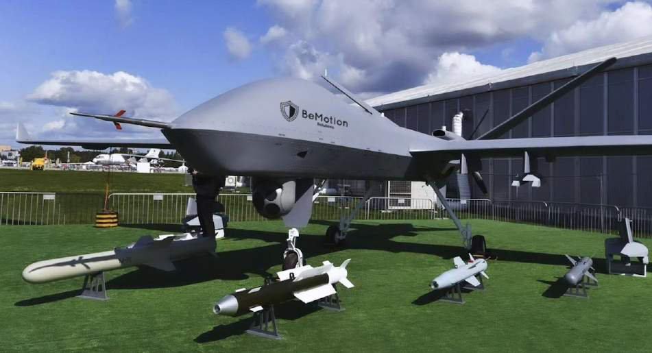
OneSalute 888LS fixed-wing UAV on the ground

Model · 888LS

OneSalute 888LS

A durable dual-engine UAV with high-quality EO/IR data collection for surveillance, reconnaissance, agricultural monitoring, environmental assessment, and infrastructure inspection.

10 hFlight time
250 kmRange
80 kgPayload
5,000 mCeiling
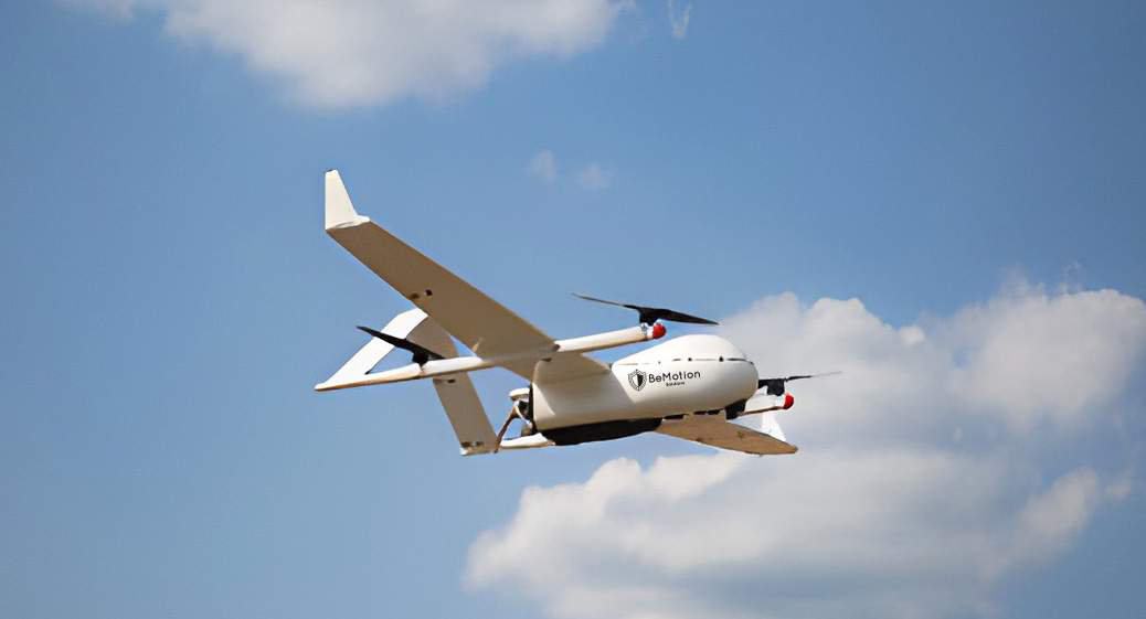
OneSalute CW-28 VTOL fixed-wing UAV in flight

Model · CW-28

OneSalute UAV CW-28

Vertical take-off and landing with fixed-wing endurance, for agriculture, environmental monitoring, infrastructure inspection, and security operations without a runway.

8 hFlight time
200 kmRange
5 kgPayload
6,000 mCeiling
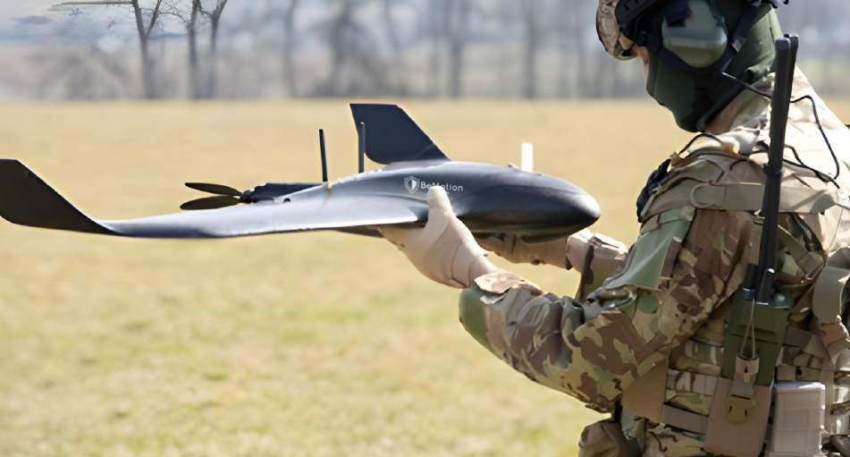
Operator hand-launching the OneSalute Vortex Vision

Model · Vortex Vision

OneSalute Vortex Vision

A hand-launched fixed-wing drone for aerial intelligence and mapping, with a 42 MP RGB camera on a 3-axis gimbal and optional thermal and multi-spectral payloads.

90 minFlight time
50 kmRange
1.6 kgWeight
4,500 mCeiling

Compare

Specifications side by side

Specification888LSCW-28Vortex Vision
TypeFixed-wing, dual engineVTOL fixed-wingFixed-wing, hand-launched
Weight300 kg (661 lb)14 kg (30.8 lb)1.6 kg (3.5 lb)
Wingspan7.5 m (24.6 ft)2.3 m (7.5 ft)116 cm (45.7 in)
Length4.6 m (15.1 ft)Not specifiedNot specified
Flight timeUp to 10 hUp to 8 hUp to 90 min
RangeUp to 250 km (155 mi)Up to 200 km (124 mi)Up to 50 km (31 mi)
Max altitude5,000 m (16,404 ft)6,000 m (19,685 ft)4,500 m (14,763 ft)
Cruise speed120–150 km/h (75–93 mph)90–120 km/h (56–75 mph)40–90 km/h (25–56 mph)
Wind resistanceUp to 70 km/h (43 mph)Up to 60 km/h (37 mph)Up to 45 km/h (28 mph)
PayloadUp to 80 kg (176 lb)Up to 5 kg (11 lb)42 MP RGB camera
Primary sensorEO/IR, stabilized gimbalEO/IR, stabilized gimbal42 MP RGB, 3-axis gimbal
Optional sensorsMulti-spectralMulti-spectralThermal, multi-spectral
Control range (LOS)Up to 200 km (124 mi)Up to 50 km (31 mi)Up to 20 km (12.4 mi)
PowerDual engine, aviation-grade fuelLi-ion, 120–150 min charge; hybrid optionLi-Po, 60–90 min charge
Obstacle detectionMulti-directionalMulti-directionalFront-facing
Autopilot GNSSGPS / GLONASS / BeiDouGPS / GLONASS / BeiDouGPS / GLONASS

Full specifications

Platform detail

888LS · full specification
General
Model
OneSalute 888LS
Type
Fixed-wing drone
Weight
300 kg (661 lb)
Wingspan
7.5 m (24.6 ft)
Length
4.6 m (15.1 ft)
Material
Advanced composite materials
Flight performance
Flight time
Up to 10 h (payload and conditions)
Range
Up to 250 km (155 mi), extended-range capable
Max altitude
5,000 m (16,404 ft) ASL
Cruise
120–150 km/h (75–93 mph)
Wind
Up to 70 km/h (43 mph)
Imaging and data
Camera
High-resolution EO/IR, day and night
Payload
Up to 80 kg (176 lb) of sensors and equipment
Multi-spectral
Optional, for agricultural and environmental analysis
Gimbal
Stabilized
Navigation and control
Autopilot
GNSS (GPS/GLONASS/BeiDou)
Ground station
Real-time data streaming and mission planning
Flight modes
Fully autonomous, semi-autonomous, manual
Communication and powertrain
Data link
Encrypted
Control range
Up to 200 km (124 mi) line-of-sight
Engine
Dual-engine configuration
Fuel
Large tanks; aviation-grade fuel
Safety and software
Obstacles
Multi-directional sensors
Failsafe
Automatic RTH, low-fuel warning, emergency landing
Compliance
International UAV safety and operational standards
Software
Mission planning; GIS and photogrammetry compatible; secure cloud storage
CW-28 · full specification
General
Model
OneSalute UAV CW-28
Type
VTOL fixed-wing drone
Weight
14 kg (30.8 lb)
Wingspan
2.3 m (7.5 ft)
Material
High-strength composite materials
Flight performance
Flight time
Up to 8 h (payload and conditions)
Range
Up to 200 km (124 mi), extended-range capable
Max altitude
6,000 m (19,685 ft) ASL
Cruise
90–120 km/h (56–75 mph)
Wind
Up to 60 km/h (37 mph)
Imaging and data
Camera
High-resolution EO/IR, day and night
Payload
Up to 5 kg (11 lb)
Multi-spectral
Optional
Gimbal
Stabilized
Navigation and control
Autopilot
GNSS (GPS/GLONASS/BeiDou)
Ground station
Real-time data streaming and mission planning
Flight modes
Fully autonomous, semi-autonomous, manual
Communication and power
Data link
Encrypted
Control range
Up to 50 km (31 mi) line-of-sight
Battery
High-capacity lithium-ion, swappable
Charging
Approx. 120–150 min
Hybrid
Optional hybrid power for extended endurance
Safety and software
Obstacles
Multi-directional sensors
Failsafe
Automatic RTH, low-battery warning, emergency landing
Compliance
International UAV safety and operational standards
Software
Mission planning; GIS and photogrammetry compatible; secure cloud storage
Vortex Vision · full specification
General
Model
OneSalute Vortex Vision
Type
Fixed-wing drone
Weight
1.6 kg (3.5 lb)
Wingspan
116 cm (45.7 in)
Material
Composite materials
Flight performance
Flight time
Up to 90 min
Range
Up to 50 km (31 mi), extended-range options
Max altitude
4,500 m (14,763 ft) ASL
Cruise
40–90 km/h (25–56 mph)
Wind
Up to 45 km/h (28 mph)
Imaging and data
Camera
High-resolution RGB, 42 MP sensor
Thermal
Optional thermal camera
Multi-spectral
Optional, for vegetation and crop health
Gimbal
Integrated 3-axis
Navigation and control
Autopilot
GNSS (GPS/GLONASS)
Ground station
Real-time data streaming and mission planning
Flight modes
Fully autonomous, semi-autonomous, manual
Communication and power
Data link
Encrypted
Control range
Up to 20 km (12.4 mi) line-of-sight
Battery
High-capacity lithium-polymer, swappable
Charging
Approx. 60–90 min
Safety and software
Obstacles
Front-facing sensors
Failsafe
Automatic RTH, low-battery warning, emergency landing
Compliance
International UAV safety and operational standards
Software
Mission planning; GIS and photogrammetry compatible; secure cloud storage

Applications

Where the fleet works

Security

Surveillance, reconnaissance, search and rescue, and border patrol.

Infrastructure

Power line, pipeline, and construction inspection.

Agriculture

Precision agriculture, field mapping, and crop health monitoring.

Environment

Wildlife monitoring, habitat analysis, and environmental surveys.

Next step

Orders and inquiries

Submit order quantities, specifications, and configuration requirements to Business Development for a quotation. All orders require an End User Certificate (EUC) from the purchasing government.